Embark on a magical journey to the top of the Matterhorn, one of the highest mountains in Europe. Discover the Hörnli Ridge, the most direct and popular route to its 4,478 metre summit.
Hike to the top of the Matterhorn via the Hörnli ridge: an unforgettable experience!
Get ready to climb the “Lion of the Alps” under the guidance of an experienced guide and enjoy spectacular views of the surrounding mountains. Your adventure starts here!

History of the Matterhorn
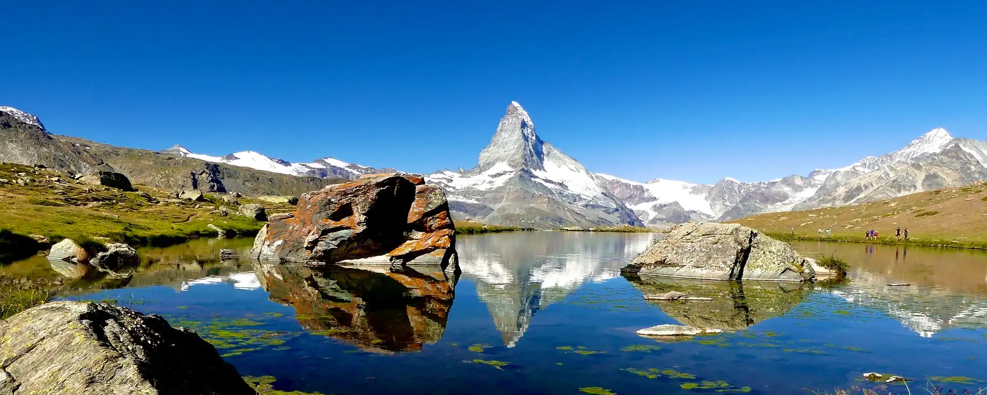
The Matterhorn is a Swiss mountain located in the municipality of Zermatt in Switzerland, which has been recognised as one of the most famous and perhaps most photographed peaks on the planet.
The imposing 4,478-metre peak rises from the valley into the sky in the shape of a perfect pyramid, earning it the nickname Matterhorn in German.
The German name “Matterhorn” derives from the German words Matte (“meadow”) and Horn (“horn or peak”), while its French name “Mont Cervin” probably comes from the Latin Mons Silvus, meaning forest pass.
Whatever the origin of its name, the characteristic shape of this mountain, which is a triangular ridge pointing to the sky, is incomparable and unique.
Mountaineers have been trying to climb the Matterhorn for years, but it was on July 14, 1865, via the Hörnli ridge that the first group led by the mountaineer Edward Whymper reached the summit.
It was followed by a second ascent a few days later, this time via the Lion ridge and led by Jean-Antoine Carrel.
Since then, the Hörnli ridge has been chosen as the main route for the ascent of the Matterhorn, due to its relative ease and speed.
Characteristics of the Matterhorn
The Matterhorn lies between the Swiss cantons of Valais and Graubünden in Italy, in the middle of the Pennine Alps.
With a height of 4,478 metres, it is considered one of the highest peaks in the Western Alps* and is one of the largest mountains in Europe.
The north face of the Matterhorn emerges from a deep valley and offers a beautiful view of the entire Alpine region. The southern part of the mountain is snow-covered and presents a wild and isolated landscape.
Due to its perfectly symmetrical pyramid shape, the mountain offers climbers several narrow and technical routes to climb its steep flank. The main routes are the Hörnli ridge (east), the Lion ridge (west) and the south face.

Recent ascents of the Matterhorn
The Matterhorn is still very popular with climbers today. Ascents must be organised in conjunction with experienced professionals to ensure the safety of the climbers during the expedition.
The guides are very well informed about all the possible routes and know every part of the mountain very well, which considerably improves the safety of the climb.
The most popular route to the Matterhorn is the Hörnli Ridge. This route can be done in one day from the nearest hut.
It starts in Zermatt and continues on foot or by cable car to the Black Lake (Schwarzsee) before walking to the Hörnlihütte mountain hut at 3,260 metres above sea level, the starting point for the ascent to the Matterhorn.
On this ascent over the Hörnli ridge, climbers use ropes along parts of the route to protect themselves from possible falls.
The Lion Ridge on the Italian side is very technical and requires several days to reach the summit. It has also gained in popularity and is now an interesting alternative to the classic routes.
Climbers who succeed in crossing the north and south faces of the Matterhorn are rewarded with a breathtaking panorama and incredible views of the Swiss and Italian Alps.
All those who have taken up this challenge say they have had a unique experience they will never forget.

Map of the Matterhorn
Location, practical information and access:
Linked
- Summits of the Alps, 4,000 metres and more, Wikipedia
- Zermatt Tourist Office
- The Matterhorn, Wikipedia


